Layer 05, Star Valley
Star Valley, Wyoming: Outdoor Recreation Guide
A green mountain valley on the western edge of Wyoming, with forest roads, rivers and a long ridge of mountains on either side. Here is how to use it, season by season.
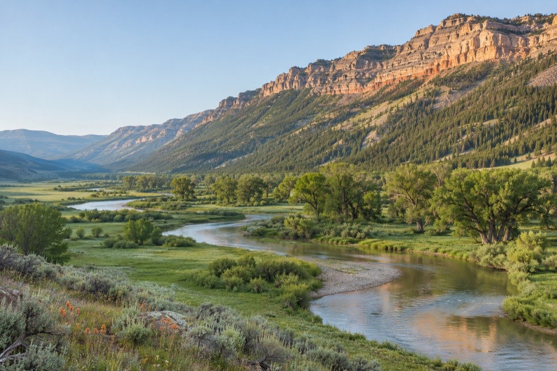
Star Valley overview
Star Valley is a valley in western Lincoln County that reaches a short distance into Idaho. Its towns follow US Highway 89, with Afton in the south, Thayne in the middle and Alpine at the northern end where the road enters the Snake River Canyon. Most of the mountains around it belong to the Bridger-Teton National Forest, which means that a large part of what you can do here takes place on public land.
What is Star Valley, Wyoming known for?
Three things come up again and again. The first is its scenery and recreation: the Salt River Range and the Wyoming Range, rivers, and the long forest road along the Greys River. The second is its history of dairy farming, which gave the valley the nickname Little Switzerland. The third is Afton's elk antler arch, which spans the highway through town and is one of the most photographed sights in the region.
Is Star Valley, Wyoming Mormon?
The valley was settled in the late 1870s by members of The Church of Jesus Christ of Latter-day Saints who came north from Utah, and that heritage still shapes local history and place names. Today the valley is open to visitors of every background and recreation is what most travellers come for. We do not publish current religious statistics, and you do not need to know anything about the history to enjoy a visit. Our history of the county explains the settlement story.
Where is it on the map?
If you are looking for an Afton, Wyoming, Star Valley map, start from the highway: US 89 runs through the valley from south to north, and Afton, Thayne, Alpine and the smaller communities line up along it. The Greys River Road leaves the highway near Alpine and heads south into the mountains. For the wider region, check the Forest Service for current maps of the Bridger-Teton National Forest, which also show the trail network and road closures.
Hiking and mountains
The Greys River Corridor is the best-documented route for exploring the mountains. According to the Forest Service, the Greys River Road is one of the most popular forest roads on the Bridger-Teton, running for almost 60 miles from Alpine south to Tri Basin Divide. The corridor gives access to several trails in the Wyoming Range and the Salt River Range, and the Forest Service lists hiking, camping, fishing, kayaking, OHV riding and horseback riding as typical activities.
Wyoming Game and Fish notes that hiking only a few miles near Palisades Reservoir rewards you with views over the reservoir, the Salt River and the Greys River. Start with a short loop, bring a map, and tell someone where you are going, because services and phone coverage are limited away from the highway.
Camping
The Forest Service lists camping among the activities along the Greys River Corridor, and camping is part of what draws people to the forest. Campground availability, fees and stay limits change from season to season, so confirm them with the Forest Service or on its reservation pages before you load the car. Dispersed camping rules differ from developed sites, so read the notices for the area you choose.
Wildlife
Wyoming Game and Fish manages a Greys River Wildlife Habitat Management Area, and the Greys River corridor is a place where hunting is also a major activity in season. Hikers and anglers should check hunting season dates and wear bright clothing in autumn. Keep a respectful distance from all wildlife and never feed animals.
Safety basics
- Check the forest website for current road and trail conditions before you go.
- Carry water, layers and a paper map in addition to your phone.
- Store food properly in camp and follow the forest's wildlife guidance, as bears live in this region.
- Weather in the mountains can change within an hour, even in summer.
Water and fishing
Rivers are central to the valley. The Salt River, the Greys River and the Snake River all meet the landscape near Alpine, and Palisades Reservoir sits at their confluence. Wyoming Game and Fish lists fishing, hunting, camping and hiking at its Greys River access area and notes that it opens the way into the Salt River Range of the Bridger-Teton National Forest.
Fishing regulations, including which species you may keep, vary from stream to stream and change from year to year. Always read the current Wyoming Game and Fish regulations and buy the licence that applies to you before you cast a line. Kayakers and paddlers should check river levels and local advice, because mountain rivers rise quickly with snowmelt.
Winter recreation
Winter brings deep snow to the mountains and a quieter valley floor. The forest roads that serve walkers and drivers in summer are covered by snow, and the rules for winter use, including which areas are open to motorised and non-motorised travel, are set by the Forest Service. Before planning any trip on snow, read the current winter notices for the Bridger-Teton National Forest and check avalanche advisories if you will be in steep terrain.
The simplest winter visit is a drive along US Highway 89 with stops in Afton and Alpine and a loop towards Jackson. Plan around road conditions, and carry chains or winter tyres, water, a blanket and a charged phone.
Nearby areas
Alpine is about 36 miles from Jackson by US Highway 89 through the Snake River Canyon, which makes Star Valley a quiet alternative base for people who plan to visit the Jackson area. Eastern Lincoln County has a very different feel: sagebrush country, coal-mining history and the fossil beds of Fossil Butte National Monument. Both halves fit into one long weekend if you accept a lot of driving.
Continue with the towns in Lincoln County to decide where to stay, or browse things to do across the whole county. Things to do in Afton, Wyoming, are mostly the activities above, plus a walk along the main street to the antler arch.